Saturday, September 3, 2011

Visual snippets from Shearwater to Telegraph Cove, BC

Clamshell beach in Fitz Hugh Sound, we spent the night in howling 30 knot wind town


While we didn't see many bears, there were plenty of beards


View from our tiny forest nook


Seastar, sandy beach, Mike brushing teeth = art


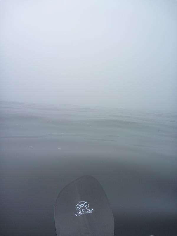
Rounding Cape Caution, the scary open ocean section we've been thinking about for months. It may seem like you can't see anything, that's cause it is very, very foggy


Cape Caution, YES!


Cape Caution, DONE!


The fog cleared and we got a beautiful sunset


Queen Charlotte is ANGRY! We stayed here two nights, that little ledge was good to us


Telegraph Cove in the sun


Sweet pics from Prince Rupert, BC to Shearwater, BC

On the water at dawn, Kitson Island.


Waterfall in Grenville Channel


Melanzana and mustachio, it's a beautiful sight


Cliffs in Princess Royal Channel


Ruins of Butedale, halfway down Princess Royal


Where we camped at Butedale, it may not look like much, but a flat spot and fresh water were much appreciated


Kelly paddling down Tolmie Channel in the rain


Old growth stump, logged long ago (you can see the horizontal slit that held up the board that the logger would stand on while felling the tree)


After 8 days of rain the sun came out at the little town of Klemtu


Our accomidations in Klemtu


Foggy Jackson Passage


We made it to Shearwater before the gale force storm


Sunday, August 21, 2011

Shearwater, B.C.

The journey from Prince Rupert to Shearwater (like all the other legs) presented new and old challenges. This was the longest leg of our trip distance-wise, we covered close to 200 miles in 12 days.

We left our cozy, almost too easy hostel in Prince Rupert in the hot sun and calm winds. But as the third day came and we entered narrow, cliffy Grenville Channel the clouds rolled in. The following week of paddling offered beautiful narrow channels, waterfalls cascading and crashing into the current driven ocean and scarce landing or camping opportunities. We were also entering the rainiest (by far) area of our trip known as the Great Bear Rainforest, home to the rare white black bear, the kermode, or spirit bear.

We heard that these channels had strong currents, lots of rain, and funneled wind. We heard right. Here are some highlights (and lowlights):

Two small human outposts broke up the wilderness. We stopped in the ruins of an old village called Butedale. We slept on a concrete slab and reloaded our water supply. The caretaker sees most parties that are paddling the inside passage each year and has been doing so for the last ten years. He told us we were the first he's seen going north to south this season and only a handful have come through heading north. It has been a slow season. The first stop after the narrow channels was a small fishing and tourism village of about 450 called Klemtu. We camped at their "campground", the gravel parking lot next to a drainpipe and the tourism office. But after a week of rain the sun came out and we got to dry our gear and ourselves.

One day after it had been raining for about 3 or 4 days already we pulled up to a rocky beach after a long day of fighting current in Grenville Channel. We set our tent up with our tarp over it amidst the driftwood at the top of the beach. We made some mac and cheese and went to sleep soundly at 8:30 ready for a good night of sleep to wake at 3:30 so we could be on the water at dawn. At about 1:00 AM I woke up to the subtle lapping sound of water. I casually glanced out of the tent and saw reflections on the sand.
"That's weird" I thought. I reached out and found about 2-3 inches of water just outside the tent. It had been raining all night and still was and at first I thought maybe a puddle had built up. I looked out the other side of the tent.
Yep...you guessed it...we miss judged the high tide and us, our tent and all of our stuff were floating in the ocean. I think I will have nightmares about what that realization felt like for a long time. We quickly through all our stuff up onto the drift logs in the pouring rain. We made sure we at least had all of our stuff, even though it was now soaking wet. The tide then shortly went back out and we reset up our drenched gear in the exact same place and laid in our sleeping bags for another 2 hours before we set off.

That was probably the worst experience I have had yet on this trip. But 4 days later the sun came out and we got to dry our stuff and it all ended up being fine. Also that morning we got to experience one of the coolest things we've seen. Another humpback feeding about 20 feet away from us, multiple times this time, and we recorded it too! They are big...

Once we left Klemtu the weather was pretty nice again and we had just a couple days to Shearwater. As we were listening to the extended forecast though we heard a huge storm coming in. Gale warnings all along the coast, as much as 40 knot winds predicted. So we ended up combining our last two days into one (helped by no wind and perfectly timed currents) and paddled 27 miles to beat the storm.

All and all it was an amazing leg, we saw some beautiful forest, cliffs and waterfalls. We managed the rain and our aching bodies during a week of long paddling days. Except for waking up in the ocean we had high spirits the whole time. And now the storm is definitely here, we are eating in the restaurant relaxing in our hotel and watching the flags violently whip in the wind and we are glad we are waiting out the storm and not out in it. Hopefully tomorrow morning we can set off for the crux of the trip, another long (11-12 days or more depending on weather) through more open ocean and around Cape Caution to the east side of Vancouver Island.

(P.S. this is one of the oldest, slowest computers ever and we will not be able to upload photos...hopefully next time!)

Saturday, August 6, 2011

Oh, Canada!

Our departure from Ketchikan was met with high winds, rain, and choppy water, and the first 3 days of the trip only resulted in 26 miles of progress. We had to settle for last-minute, improvised campsites when conditions deteriorated, and we were sure we'd be behind schedule getting into Prince Rupert. A few days of gorgeous weather turned everything around, though, and we quickly made up for lost time (60 miles in 3 days) and arrived a day early! It's amazing what a difference good weather can make, and this weather provided some of our best days of kayaking yet.


The good weather came just in time, too, as we approached Dixon Entrance, the first open-ocean section of the trip. About 12 miles of coast, from Foggy Point to Cape Fox, are completely exposed to the Pacific, and the more "protected" sections to the north and south are still subject to swell. We passed through Foggy Bay (the last bit of shelter before the Big Scary Part) on a calm, sunny afternoon and decided that the weather was nice enough to head around the point before setting up camp. The next morning we set out on silky smooth water under a deep pastel surise. It was going to be a good day. Hardly a crashing wave was to be heard as we paddled through the gentle swell, past fishing boats and harbor seals. The peaceful morning opened up into a beautiful, sparkling sunny day of benign seas and gorgeous paddling. We couldn't believe how lucky we were to experience such an amazing day. A day that pries your heart wide open and stuffs the whole universe inside. Humpbacks and sea lions escorted us along the coast, past our intended stopping point, on and on across the border into Canada. 24 miles after we set out for the day, we touched down on the white sand beaches of Boston Island, BC. We enjoyed some relaxing, some dinner, and some sleep before waking up under a clear starry sky to enjoy another day of perfection.


After a smooth early morning crossing of Portland Inlet, we were headed around a point where a rocky reef had been exposed at low tide. We had seen humpback spouts rising from the other side of the rocks, but the whale seemed to be moving across our path. By the time we got around the point, it would probably be off in the distance...
As we came around the rocks the water in front of us started to bubble. Smallish bubbles at first, then larger ones, quickly rising to the surface.
"Is that a fish?"
The bubbles started to form a large circle.
"Um, I think that's a whale."
It's a funny thing to be in a tiny boat and realize that a giant whale is right beneath you.
Just as we started to back paddle, a giant, black head burst through the middle of the bubble net, ribbed throat stretched wide. The humpback turned, crashing down into the water and raising a long pectoral fin into the air. The fin slapped the surface as the whale sank back down, and then quiet ripples were the only indication that anything had been there at all. All of this happened in about 3 seconds, maybe 10 feet in front of our kayaks. A mix of amazement, excitement, and panic sent our hearts racing as we tried to move out of the way, closer to shore, wondering where he would pop up next. A minute or so later we saw him again. Still close, but moving behind us into open water as we headed around a corner. With wide grins on our faces we paddled on in disbelief. Just another day on the Inside Passage.

Pictures!! Ketchikan to Prince Rupert, BC

Greetings from Canada! Here are a few pics from the past week. Stay tuned for more highlights.


Strolling along Creek Street in Ketchikan


Making couscous on a stormy evening on the approach to the Dixon Entrance


Rainbows and purse seiners at 5 a.m.


Cool root mass on teeny weeny Black Island


A lovely evening at Foggy Point...what ocean swell?


Leaving Foggy Point at dawn


Staking our claim in Canada! (Boston Island)


Cow Bay, Prince Rupert, BC


Always on the lookout for cool rocks


Wednesday, July 27, 2011

Kickin' it in Ketchikan

Greetings from Ketchikan! Our favorite town thus far...We've paddled a little over 400 miles in just over a month, and we're a third of the way done with our trip (and on time too boot)! Craazy! This is our last stop in Alaska before crossing the border (in a few days) into Canada. Here are a some highlights from the past week:

We enjoyed a few days in the tiny town of Wrangell. Things were stressful for a bit since every hotel/motel/B&B in town was booked (due to construction--heh), but we ended up setting up shop at the hostel run by the Presbyterian Church. We were forced into relaxation for a day since the whole town shuts down on Sundays (including grocery stores), but managed to run all of our errands and get resupplied in due time. I even got to have a pre-birthday fried feast, complete with a requisite Manhattan, before heading out of town on a foggy, misty morning.

Our first few days out were in very protected waters, which made for pretty easy paddling--low mileage, early mornings to catch favorable currents, mostly calm water, and a little rain here and there. After rounding the corner where Ernest Sound meets Clarence Strait, on the western side of the Cleveland Peninsula, things got a little more interesting. The Clarence Strait section of the paddle was full of firsts:

Our First Small Craft Advisory: Two of them actually! The first provided a welcome opportunity to sleep in until the advisory was lifted, the second led us to...

...Our First Weather Day: According to our guide book, Clarence Strait is "not bedeviled by stormy seas," and yet there we were, looking at frothy, 3 to 4-foot whitecaps racing into the rocks that we were camped above. Clarence Strait is long and wide, and even 10-15 knot winds over that much fetch could build up impressive waves. We probably could have paddled, but we certainly wouldn't have gotten anywhere with any kind of efficiency. The idea of packing up camp to spend a lot of energy paddling nowhere just didn't seem worth it. So we stayed put for a day, feeling a little annoyed, but glad to have whiskey. It was at this campsite, the night before our weather day that we had...

...Our First Bear Near Our Campsite Encounter: We had stopped at that site the afternoon before, to get out of the building wind, realized it wasn't going to abate, and decided to camp. We had just started making dinner when Mike stood up to to stretch.
Mike: "Oh. There's a bear."
Kelly (busily slicing cheese and swatting at bugs): "Huh?"
Mike: "There's a bear right there."
Kelly (turning to look, and noticing a black bear, about 30 yards away, ambling
along the beach, turning over rocks and digging for tasty morsels): "...Oh...yeah..."
It was about time, really. A month of camping in bear country without running into one (we had seen them from our kayaks) seemed to be pushing our luck. Mr. Bear hadn't noticed us at all, and it would've been pretty cool to just sit and watch it do it's thing if it weren't for the fact that it was making its way toward where we were cooking. We stood up, waved our arms, and loudly announced ourselves. The bear looked up in surprise, turned away, looked back, then scampered off into the woods. I felt a little bad for interrupting its beachcombing. We congratulated ourselves on our bear-scaring abilities, moved our kitchen to a different part of the beach, and went to bed knowing that at least the bear knew we were there and didn't really want much to do with us. Good thing, too, since we had to spend a second night...

The weather still wasn't super awesome after that, as the weather front continued to stall out. The next day we only managed 10 miles before the wind drove us off the water. With another (stronger) front forecasted to move in, we took advantage of a tiny window of early morning calm to make our way out of the Strait and across the 5-mile-wide Behm Canal. The last 10 miles down Tongass Narrows to Ketchikan was full of wind, chop, and developed waterfront. Finally, after 21-miles and a 13-hour day, we made it! We had our easiest docking/accomodation finding/gear moving yet, and now we're kickin' it in the beautiful New York Hotel, right at the entrance to Creek Street. Today was spent running errands, and tomorrow we get to play tourist.

Oh yeah, and I turned 27! Thanks for all the birthday wishes, everyone! It was a great day, and a humpback even popped by to say hell0.

Pictures!

Here are pictures from both the Juneau to Wrangell and Wrangell to Ketchikan leg. They are in no specific order (it is hard to organize pictures on this website). We will follow soon with a worded update about the last leg of our trip, it is just easier to do an all picture post and an all word post separately.

Pushing the tram with all of our stuff across the mile long portage to Fool's Inlet

Dragging, lifting and floating our boats trying to beat the dried out high tide to get out of Fool's Inlet

Rocky coastline

Heading to retrieve the tram on the portage

Us

More coastline

Black bear, just near where we wanted to camp...

Sunset on "Porcupine Island", named so because Kelly saw a porcupine on the beach

Watching humpbacks put on a show in the 5 1/2 mile crossing of Stephen's Passage that we completed the next morning


Coming into Wrangell, you can see the divide between water coming out of the Stikine river (the lighter color because of all the sediment) and the water coming out of the back passage


Rockweed and waves enough to take a rest day

Getting into Ketchikan, cruise ships are biiiiiigggggg

View of Ketchikan from our window in the historic New York Hotel

Bull Kelp, clouds and calm water